GPS is a technology most people use every day without thinking twice about how it works or what it actually means. Whether you’re using Google Maps for directions, tracking a food delivery, or sharing your live location with friends, GPS plays a key role in making these features possible.
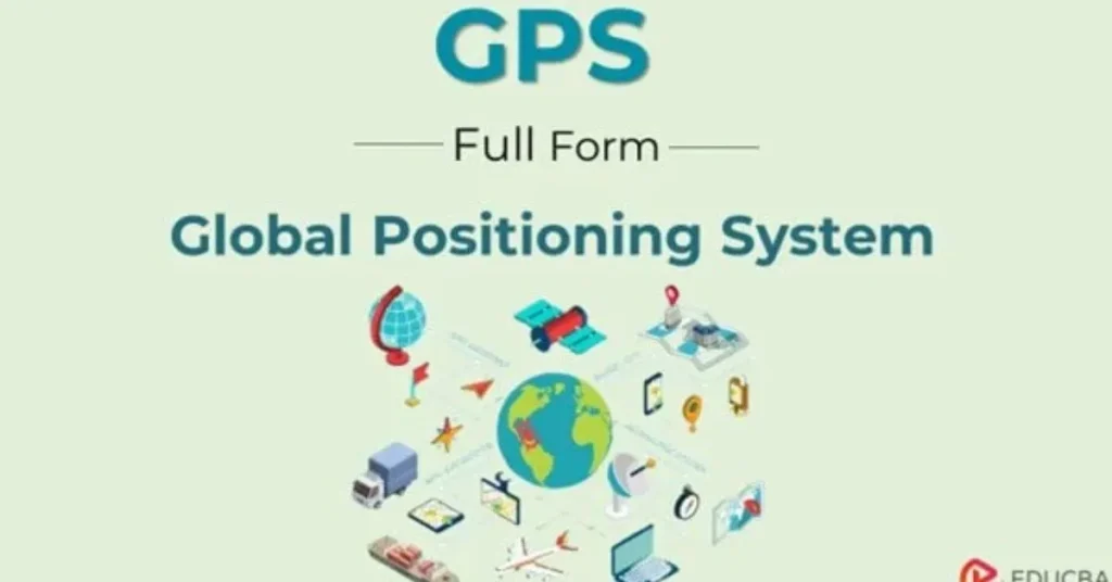
But many people still ask a simple question: what does GPS stand for? GPS stands for Global Positioning System, a satellite-based navigation system that helps determine exact locations anywhere on Earth.
Originally developed for military use, GPS is now freely available to civilians and is built into smartphones, vehicles, fitness trackers, and many other devices.
Understanding what GPS means and how it functions can help you better appreciate the technology behind modern navigation and location tracking.
In this article, we’ll explain what GPS stands for, how it works, its main components, common uses, advantages, limitations, and why it has become such an essential part of everyday life.
What Does GPS Stand For?
GPS stands for Global Positioning System. It is a satellite-based navigation system designed to provide accurate location and time information anywhere on Earth. The word global highlights that GPS works worldwide, positioning refers to determining an exact location, and system means it is made up of multiple interconnected components working together.
In simple terms, GPS helps devices figure out where they are, how fast they are moving, and what time it is by communicating with satellites orbiting the Earth. These satellites continuously send signals down to GPS receivers, such as smartphones, car navigation systems, and smartwatches. By measuring how long it takes for these signals to reach the receiver, the device can calculate its precise position.
The Global Positioning System was originally developed by the United States Department of Defense for military navigation and operations. Over time, it was made available for civilian use, allowing people around the world to benefit from accurate navigation and location services. Today, GPS is not owned by private companies; it is maintained by the U.S. government and offered free of charge to users globally.
Because of its reliability and worldwide coverage, GPS has become the foundation of modern navigation technology. From finding nearby places to coordinating emergency responses, understanding what GPS stands for helps explain why this system is so important in daily life.
What Is GPS? (Detailed Explanation)
GPS, or the Global Positioning System, is a satellite-based navigation system that allows devices to determine their exact location anywhere on Earth. It works by using a network of satellites orbiting the planet that continuously transmit signals to GPS receivers on the ground. These receivers analyze the signals to calculate precise information about location, speed, direction, and time.
Unlike traditional navigation methods that rely on maps or physical landmarks, GPS provides real-time positioning with a high level of accuracy. A GPS-enabled device does not send signals to satellites; instead, it only receives signals. By connecting to at least four satellites at the same time, the device can determine its position using a mathematical process called trilateration.
GPS was initially created for military purposes such as navigation, troop movement, and missile guidance. However, its usefulness quickly expanded beyond defense. In the 1980s and 1990s, GPS was opened for civilian use, leading to its integration into cars, mobile phones, aircraft, ships, and wearable technology.
One of the most important features of GPS is that it works 24/7, in all forecast conditions, and anywhere in the world as long as the receiver has a clear view of the sky. GPS also does not require an internet connection to determine location, which makes it especially useful in remote areas.
Today, GPS is an essential part of modern technology. It supports navigation apps, emergency services, transportation systems, scientific research, and even financial networks that depend on precise timing. Understanding what GPS is helps explain why it has become such a powerful and widely used technology worldwide.
History and Origin of GPS
The history of GPS dates back to the Cold War era, when accurate navigation and positioning became critical for military operations. The Global Positioning System was developed by the United States Department of Defense in the early 1970s to improve navigation for military aircraft, ships, and ground forces. The project was originally known as NAVSTAR GPS, and its goal was to provide precise location information anywhere in the world at any time.
The first experimental GPS satellite was launched in 1978, marking a major milestone in satellite navigation technology. Over the next several years, additional satellites were placed into orbit to expand coverage and improve accuracy. By the mid-1990s, the full GPS satellite constellation was completed, allowing the system to achieve global coverage.
Although GPS was initially restricted to military use, the U.S. government recognized its potential civilian benefits. In 1983, after a tragic incident involving a commercial aircraft that went off course, the decision was made to allow civilian access to GPS technology. However, civilian signals were intentionally degraded through a feature called Selective Availability to limit accuracy. This restriction was later removed in 2000, greatly improving GPS accuracy for public users.
Since then, GPS has continued to evolve with better satellites, improved signal accuracy, and increased reliability. Today, GPS is used worldwide for navigation, transportation, emergency response, scientific research, and everyday smartphone applications. Its transformation from a military tool to a global public utility highlights its importance in modern life.
How Does GPS Work? (Step-by-Step)
GPS works through a network of satellites orbiting the Earth, which continuously transmit signals containing information about their position and the exact time the signals are sent. These signals are picked up by GPS receivers, such as those in smartphones, car navigation systems, or smartwatches. The receiver uses these signals to calculate its precise location using a method called trilateration.
Trilateration requires signals from at least four satellites. The GPS receiver measures the time it takes for each satellite’s signal to reach it, then multiplies this time by the speed of light to determine the distance from each satellite. By combining distance measurements from multiple satellites, the receiver can pinpoint its exact position in three dimensions: latitude, longitude, and altitude.
In addition to position, GPS also provides speed and direction, which is why navigation apps can tell you how fast you are moving and the direction you are heading. The system relies on atomic clocks in satellites, which are extremely precise and ensure accurate timing. Even a tiny timing error can result in a large location inaccuracy, so these clocks are crucial for reliable GPS calculations.
GPS signals are designed to work anywhere on Earth, 24 hours a day, in all cloudburst conditions, as long as the receiver has a clear line of sight to the sky. While GPS works without the internet, many apps combine GPS with internet-based maps and traffic data to provide enhanced navigation features.
In short, GPS works by receiving satellite signals, calculating distances, and using trilateration to determine accurate location, speed, and time. This combination of satellites, receivers, and precise timing makes GPS one of the most reliable navigation systems in the world.
Main Components of the GPS System
The Global Positioning System is made up of three main components, each playing a critical role in ensuring accurate and reliable location information: the space segment, the control segment, and the user segment. Together, these components form a complete system that allows GPS to function globally.
1. Space Segment (Satellites)
The space segment consists of a constellation of at least 24 operational satellites orbiting the Earth at approximately 20,200 kilometers (12,550 miles) above the surface. These satellites continuously transmit signals containing their position and precise time information. By maintaining constant visibility from anywhere on Earth, the satellites provide the foundation for GPS’s global coverage. Each satellite is equipped with atomic clocks, which ensure extremely accurate timing essential for determining precise locations.
2. Control Segment (Ground Stations)
The control segment includes a network of ground control stations located around the world. These stations monitor and manage the satellites, tracking their positions, updating navigation data, and ensuring proper functioning. Ground stations also correct any deviations in satellite orbits and clock errors, maintaining the overall accuracy and reliability of the system. Without the control segment, the satellite signals would gradually drift, leading to inaccurate positioning.
3. User Segment (Receivers)
The user segment consists of GPS receivers, which can be found in smartphones, cars, watches, airplanes, and ships. Receivers detect signals from multiple satellites and use the information to calculate exact positions, speed, and time. Advanced receivers can connect to additional satellite systems for improved accuracy.
In summary, GPS relies on the satellites to broadcast signals, the ground control stations to monitor and correct data, and receivers to interpret the signals, forming a robust system that delivers accurate navigation information worldwide.
Types of GPS Systems
The Global Positioning System is not a single, uniform service; it consists of different types of GPS systems and services designed to meet specific needs. Understanding these types helps explain how GPS can serve both civilians and the military while maintaining accuracy and reliability.
1. Standard Positioning Service (SPS)
The Standard Positioning Service is the GPS system available to the public. It provides accurate location, speed, and time information for civilian users worldwide. SPS signals are free to use and can be accessed through smartphones, car navigation systems, wearable devices, and many other applications. The system is highly reliable and accurate enough for most everyday navigation and tracking purposes.
2. Precise Positioning Service (PPS)
The Precise Positioning Service is reserved for authorized military users. PPS provides higher accuracy than the standard civilian service, often using encrypted signals to ensure secure and reliable military operations. This type of GPS is critical for defense applications, including navigation, targeting, and reconnaissance.
3. Assisted GPS (A-GPS)
Assisted GPS is a modern variation that improves the speed and accuracy of traditional GPS, especially in environments with weak satellite signals, such as cities with tall buildings. A-GPS works by combining GPS signals with data from cellular networks or Wi-Fi to help devices locate their position faster. It is widely used in smartphones and wearable devices.
4. Differential GPS (DGPS)
Differential GPS is designed to improve location accuracy even further. It uses ground-based reference stations to broadcast corrections to GPS signals, reducing errors caused by atmospheric conditions or satellite inaccuracies. DGPS is often used in aviation, marine navigation, and surveying, where high precision is crucial.
Each type of GPS system has a unique role, but together they ensure that both civilian and military users can rely on GPS for accurate, real-time positioning anywhere on Earth.
Accuracy of GPS
GPS is renowned for its ability to provide highly accurate location information anywhere on Earth. However, the accuracy of GPS signals can vary depending on several factors, including the type of GPS system used, the environment, and the quality of the receiver. Generally, civilian GPS devices provide accuracy within 5 to 10 meters, while military-grade systems using Precise Positioning Service (PPS) can achieve accuracy within centimeters.
Several factors influence GPS accuracy. One of the main factors is satellite geometry, which refers to the relative positions of satellites in the sky. When satellites are spread out widely, the system can calculate positions more precisely. If satellites are clustered too closely, the accuracy decreases.
Another factor is signal obstruction. GPS signals can be blocked or weakened by tall buildings, dense forests, tunnels, or mountains, reducing accuracy. This is why GPS often struggles indoors or in urban “canyons” formed by skyscrapers.
Atmospheric conditions also affect GPS. Signals pass through the ionosphere and troposphere, where changes in air density or charged particles can slow them down slightly, causing minor inaccuracies. Advanced receivers often use correction algorithms or combine GPS with other satellite systems to compensate for these errors.
Finally, the quality of the GPS receiver itself matters. High-end receivers in cars, ships, or aircraft are more sensitive and can use multiple satellite signals simultaneously, while smartphones may have slightly lower precision.
Despite these challenges, GPS remains one of the most reliable navigation systems available. With modern enhancements like DGPS, A-GPS, and multi-constellation support, GPS can deliver accuracy suitable for everyday navigation, professional applications, and critical safety operations.
Common Uses of GPS
GPS has become an essential technology in modern life, serving a wide range of applications across multiple industries. Its ability to provide real-time location, speed, and timing information makes it indispensable for navigation, tracking, and safety.
1. Navigation and Mapping
One of the most common uses of GPS is in navigation. Apps like Google Maps, Waze, and Apple Maps rely on GPS to provide turn-by-turn directions, real-time traffic updates, and route optimization. Drivers, cyclists, and pedestrians depend on GPS for efficient and accurate navigation.
2. Transportation and Logistics
GPS is critical in managing fleets, tracking shipments, and optimizing delivery routes. Companies in logistics, ride-sharing, and shipping use GPS to monitor vehicles, improve efficiency, and ensure timely delivery.
3. Smartphones and Apps
Beyond maps, GPS powers location-based apps like ride-hailing, food delivery, and social media check-ins. Smartphones use GPS to locate users, provide nearby suggestions, and enable location sharing with friends and family.
4. Fitness and Health
Wearable devices and fitness apps rely on GPS to track running, cycling, hiking, and other outdoor activities. GPS provides data on distance, speed, and elevation, helping users monitor progress and improve performance.
5. Emergency and Safety Services
GPS plays a crucial role in emergency response. Ambulances, firefighters, and rescue teams use GPS to navigate quickly to locations, locate lost individuals, and coordinate operations during disasters.
6. Aviation and Marine Navigation
Aircraft and ships depend on GPS for precise navigation, route planning, and safety. GPS helps pilots and captains avoid obstacles, maintain schedules, and operate efficiently even in remote areas.
In short, GPS is not just a convenience it has become a backbone technology, supporting everyday navigation, professional operations, safety, and recreational activities worldwide.
Advantages of GPS
The Global Positioning System offers numerous advantages that make it an essential technology for both everyday life and professional use. Its reliability, precision, and global accessibility are key factors that have driven its widespread adoption.
1. Global Coverage
One of the main advantages of GPS is its ability to work anywhere on Earth. With a network of at least 24 satellites in orbit, GPS provides worldwide coverage, allowing users to determine their location regardless of whether they are in a city, remote forest, or open ocean.
2. High Accuracy
GPS delivers accurate positioning, often within a few meters for civilian users and even centimeter-level accuracy for specialized applications like surveying, aviation, and military operations. Advanced GPS receivers and correction systems, such as Differential GPS (DGPS), enhance precision even further.
3. Real-Time Navigation
GPS enables real-time location tracking, making it invaluable for navigation, transportation, and logistics. Drivers can follow turn-by-turn directions, emergency responders can reach destinations faster, and delivery companies can optimize routes to save time and fuel.
4. Free Access for Civilians
Unlike many other technologies, GPS is freely available to anyone with a receiver. Civilians do not need subscriptions, and smartphones, vehicles, and wearable devices can all access GPS signals without additional costs.
5. Wide Range of Applications
GPS supports countless applications beyond navigation. It is used in aviation, marine travel, fitness tracking, agriculture, scientific research, and even time synchronization for financial systems.
6. Reliable and Consistent
GPS works 24/7, in all downfall conditions, and in most environments, making it a dependable system for both personal and professional use.
Overall, GPS combines global reach, high accuracy, and versatility, making it one of the most useful and transformative technologies of the modern era.
Limitations of GPS
While GPS is a powerful and widely used technology, it has several limitations that can affect its performance and reliability in certain situations. Understanding these limitations helps users set realistic expectations about what GPS can and cannot do.
1. Signal Obstruction
GPS signals are transmitted from satellites orbiting high above the Earth, which means they can be blocked or weakened by tall buildings, dense forests, tunnels, or mountains. This is why GPS devices often struggle in urban “canyons” or indoors, where the line of sight to satellites is partially or completely obstructed.
2. Accuracy Limitations
Although GPS is generally accurate within a few meters for civilian use, its precision can be affected by factors like satellite geometry, atmospheric conditions, and signal interference. For applications requiring extreme accuracy, such as surveying or precision agriculture, additional correction systems like Differential GPS (DGPS) or Real-Time Kinematic (RTK) are often necessary.
3. Dependence on Satellite Visibility
GPS relies on signals from multiple satellites. If fewer than four satellites are visible, the receiver cannot determine an accurate three-dimensional location. Poor outlook, satellite outages, or interference can temporarily reduce reliability.
4. Battery and Device Limitations
Continuous use of GPS can drain device batteries quickly, especially in smartphones and portable devices. Additionally, older or low-quality receivers may struggle to maintain consistent accuracy.
5. Security and Privacy Concerns
GPS can expose user location data, which may be misused if proper privacy measures are not taken. GPS signals can also be spoofed or jammed, potentially causing errors in critical systems such as aviation or maritime navigation.
Despite these limitations, GPS remains one of the most reliable global navigation technologies. Awareness of its constraints allows users to optimize performance, use complementary systems, and maintain safe and accurate navigation.
Navigation Systems Global GPS vs Other
While GPS is the most widely known satellite navigation system, it is not the only one. Several other countries and organizations have developed their own Global Navigation Satellite Systems (GNSS), each with unique features and advantages. Comparing GPS to these systems helps highlight its strengths and limitations.
1. GPS (United States)
The Global Positioning System, operated by the U.S. Department of Defense, provides global coverage and is freely accessible to civilians. GPS has a constellation of at least 24 satellites, offering reliable accuracy of 5–10 meters for civilian use and centimeter-level precision for military and specialized applications. Its widespread adoption makes it the default navigation system for most smartphones, vehicles, and apps.
2. GLONASS (Russia)
GLONASS, operated by Russia, is similar to GPS and provides global coverage. It is often used in combination with GPS to improve accuracy, particularly in high-latitude regions where GPS coverage may be slightly weaker. GLONASS also has a comparable number of satellites and can serve as a backup system in case GPS signals are unavailable.
3. Galileo (European Union)
Galileo is Europe’s GNSS and offers high-precision services for both civilian and commercial use. It is designed to provide better accuracy than GPS, particularly in urban environments, and is interoperable with GPS and GLONASS. Galileo emphasizes civil applications and independence from military control.
4. BeiDou (China)
China’s BeiDou Navigation Satellite System provides global coverage and is rapidly expanding its capabilities. BeiDou is increasingly integrated into smartphones, vehicles, and commercial navigation systems, offering an alternative to GPS in Asia and worldwide.
5. Multi-Constellation Use
Modern GPS receivers often use signals from multiple GNSS systems simultaneously. This multi-constellation approach improves accuracy, reliability, and satellite availability, especially in challenging environments like cities, mountains, or dense forests.
In conclusion, while GPS remains the most popular and widely used system, combining it with GLONASS, Galileo, or BeiDou enhances positioning accuracy and reliability for both civilian and professional applications.
Technology GPS in Modern Era
GPS has become a cornerstone of modern technology, far beyond simple navigation. Its precise positioning and timing capabilities have transformed industries, everyday life, and even scientific research.
1. Smartphones and Apps
GPS is integrated into almost every smartphone, enabling location-based services, maps, ride-sharing apps, food delivery tracking, and social media features. Applications rely on GPS to provide real-time directions, suggest nearby places, and allow users to share their exact location with friends or emergency services.
2. Autonomous Vehicles
Self-driving cars depend heavily on GPS for navigation and safety. GPS helps these vehicles determine their precise location on the road, plan optimal routes, and avoid collisions.
3. Internet of Things (IoT) Devices
GPS plays a critical role in IoT technology. From smart watches and fitness trackers to connected vehicles and logistics sensors, GPS provides essential location and timing data. This enables remote monitoring, fleet management, and real-time tracking for businesses and consumers alike.
4. Aviation and Marine Navigation
Aircraft and ships rely on GPS for safe navigation, flight planning, and route optimization. GPS allows pilots and captains to operate in challenging environments, maintain schedules, and reduce fuel consumption.
5. Agriculture and Surveying
Precision agriculture uses GPS for mapping fields, guiding tractors, and monitoring crops, increasing efficiency and reducing waste. Surveyors and construction professionals rely on GPS for accurate measurements and project planning.
6. Scientific Research and Disaster Management
GPS supports earthquake monitoring, forecast forecasting, wildlife tracking, and disaster response. Emergency responders use GPS to locate people in need quickly and coordinate relief efforts efficiently.
In essence, GPS is no longer just a navigation tool it has become a foundational technology that underpins countless modern applications, improving safety, efficiency, and convenience across multiple sectors.
Privacy and Security Concerns of GPS
While GPS offers incredible convenience and functionality, it also raises privacy and security concerns that users should be aware of. Because GPS continuously tracks location, misuse or unauthorized access to this data can pose serious risks.
1. Location Tracking and Privacy
Many devices and apps use GPS to monitor users’ movements. Without proper safeguards, this data can be accessed by third parties, advertisers, or malicious actors.
2. GPS Spoofing
GPS signals are weak when they reach the Earth’s surface, making them susceptible to spoofing attacks. In spoofing, a malicious actor transmits fake GPS signals to trick receivers into calculating incorrect positions. This can disrupt navigation systems in cars, ships, aircraft, or drones, posing serious safety risks.
3. GPS Jamming
Another threat is jamming, where devices emit interference that blocks GPS signals. Jamming can temporarily disable GPS receivers, affecting navigation and critical services, including emergency response and aviation.
4. Security in Military and Sensitive Applications
Because GPS is essential for military operations, protecting signal integrity is critical. The military uses encrypted signals and other security measures to prevent adversaries from interfering with GPS. Civilian users, while not targeted, can still be indirectly affected by disruptions.
5. Best Practices for Users
To stay secure, users should:
- Limit location sharing to trusted apps and contacts
- Keep devices updated to patch vulnerabilities
- Use multi-constellation or hybrid navigation systems to reduce reliance on a single GPS signal
In conclusion, while GPS is invaluable, awareness of its privacy and security risks is essential to ensure safe and responsible use in daily life.
GPS Fun and Lesser Facts
While GPS is a technology we use daily, there are several interesting and surprising facts about it that most people don’t know. These facts highlight how advanced, precise, and widespread GPS technology has become.
1. Atomic Clocks in Space
Each GPS satellite carries multiple atomic clocks, which are incredibly precise and can measure time down to billionths of a second. These clocks are essential because even a tiny timing error can result in a location error of several kilometers.
2. GPS Satellites Orbit the Earth Every 12 Hours
The satellites orbit at an altitude of about 20,200 kilometers (12,550 miles) and complete two full orbits every 24 hours. Their positions are carefully calculated so that at least four satellites are visible from anywhere on Earth at all times.
3. GPS Was Initially Military-Only
GPS was developed by the U.S. Department of Defense in the 1970s and was used exclusively for military navigation. Civilian access was only granted after a major airplane accident in 1983, showing its potential to save lives.
4. GPS Signals Can Travel Through the Atmosphere
Despite passing through the ionosphere and troposphere, GPS signals can still reach Earth’s surface. However, atmospheric conditions can slightly delay the signals, which is why correction systems like Differential GPS (DGPS) exist to improve accuracy.
5. GPS is Free for Everyone
One surprising fact is that civilians can use GPS anywhere in the world for free. While it was a military system originally, the U.S. government provides public access without any subscription fees.
6. Unexpected Everyday Uses
Beyond navigation, GPS helps track wildlife, monitor earthquakes, synchronize financial networks, and guide farming equipment. Its applications are far-reaching and often invisible to everyday users.
In short, GPS is a technological marvel, combining satellites, atomic clocks, and sophisticated algorithms to make modern life easier, safer, and more connected than ever.
Frequently Asked Questions (FAQs) About GPS
GPS is a technology that most people use every day, yet it often raises questions about how it works, its accuracy, and its limitations. Here are some of the most common questions answered clearly.
1. What does GPS stand for in simple words?
GPS stands for Global Positioning System. It is a network of satellites that helps devices determine their exact location anywhere on Earth.
2. How does GPS work?
GPS works by receiving signals from at least four satellites. The device calculates the time it takes for the signals to arrive and uses this information to determine latitude, longitude, and altitude through a process called trilateration.
3. Does GPS work without internet?
Yes, GPS does not require an internet connection. It works using satellite signals. However, apps like Google Maps may need internet for map data, real-time traffic, or route updates.
4. How accurate is GPS?
For most civilian devices, GPS is accurate within 5 to 10 meters. Accuracy can improve using correction systems like Differential GPS (DGPS) or multi-constellation receivers that combine GPS with GLONASS, Galileo, or BeiDou satellites.
5. Who owns GPS?
GPS is owned and maintained by the United States government, specifically the U.S. Department of Defense. It is freely available for civilian use worldwide.
6. Can GPS work indoors?
GPS signals are weak indoors or underground because satellites are blocked by walls or roofs. In such cases, assisted GPS (A-GPS) or Wi-Fi-based positioning helps improve location detection.
7. What are the risks of using GPS?
GPS can expose location information, which may affect privacy. Signals can also be spoofed or jammed, although such attacks are rare for everyday users.
GPS is a reliable, global system that powers modern navigation, tracking, and countless technologies, making it an essential part of daily life.
Conclusion
The Global Positioning System, or GPS, has transformed the way we navigate, track, and interact with the world around us. From its beginnings as a military tool in the 1970s to its widespread civilian use today, GPS has become an essential part of modern life.
By understanding what GPS stands for Global Positioning System we gain insight into how this technology works, its components, and the reasons for its global importance.
GPS functions through a network of satellites, ground control stations, and user receivers, working together to provide accurate location, speed, and time information anywhere on Earth.
Its applications are virtually limitless: navigation for drivers and pilots, tracking shipments and fleets, enabling smartphone apps, supporting emergency services, guiding autonomous vehicles, and even assisting in scientific research and agriculture.
GPS has also become integral to the Internet of Things, connecting devices and improving efficiency across multiple industries.
While GPS offers many advantages, including global coverage, high accuracy, and real-time navigation, it does have limitations such as signal obstruction, humidity interference, battery consumption, and privacy concerns. Awareness of these limitations helps users make the most of GPS technology safely and responsibly.
In conclusion, GPS is more than just a navigation tool it is a foundational technology that shapes transportation, communication, safety, and everyday convenience.
Its global reach, reliability, and versatility make it indispensable, and as technology continues to evolve, GPS will remain at the heart of innovation, connecting people, devices, and systems across the world.

Swaan was born in Cambridge, the eldest of three children of pathologist Meredith Blake Robson Swaan and his wife, Marjorie Dykes.
Swaan was educated at King’s College School, Cambridge, and then at Winchester College, a boarding independent school for boys in the city of Winchester in Hampshire, where he was an exhibitioner. He then studied zoology at Gonville and Caius College, Cambridge, where he graduated MA and PhD.